Friday May 19 2006
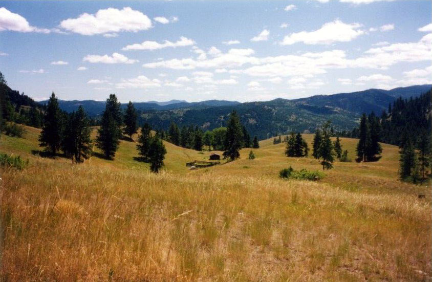
Today saw us travel from Grand Forks to New Denver on the east side of Slocan Lake. From Grand Forks we traveled over Paulsen Pass into Castlegar then we turned north up the Slocan Valley to Slocan Lake. Spectacular! River levels were very high and there was a flood warning for local residents. We had considered this area to live in and there were some great hobby farms for sale but the lack of flat water paddling and limited road riding made us carry on to New Denver. New Denver is a terrific little town. It sits on the east shore of Slocan Lake.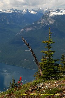 Valhalla Provincial Park to the west with the New Denver Glacier hanging off the front of the mountain peak. We camped just outside of town on Wilson Creek. Paddling was terrific. Imagine kayaking on the lake in the first Lord of the Rings movie. Waterfalls dropping into the dead calm water. Deer browsing on the cliffs above. Hundreds of streams and creeks cascading down into the lake and me, the only one on it. The lake itself is about 2,000’ above sea level and the peaks above are about 8,000’. New Denver is centered between 4 provincial parks which incorporate parts of the Valhalla, Purcell and Monashee mountain ranges. Arguably the best back country skiing in the world.
Saturday May 20 2006
I rode the Wilson Creek trail. Flows really well with some good climbs. A solid cross country ride. As I crossed a cut block about 100 meters down slope I am sure I passed a grizzly bear. It must have been 4.5’ at the shoulder. It glanced over its shoulder at me as it casually browsed on some grass. I have had many bear encounters in the woods but this is only the second time I have encountered a grizzly and I can tell you they scare the shit out of me. I had hoped to mtn bike the Wakefield Trail off of Idaho Peak. This trail starts at 2205m and ends at about 600m. It traverses alpine meadow avalanche slope and rain forest. I will have to return in a couple months when the snow is gone.
Sunday May 21 2006
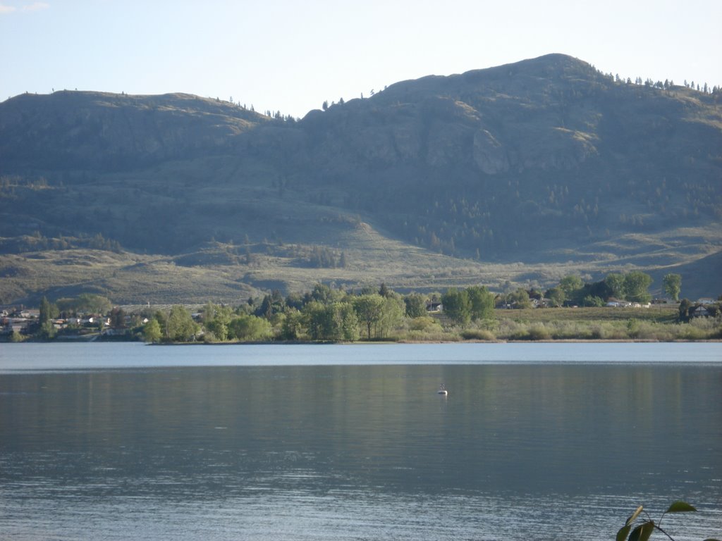
We have decided to move one mountain range east to the small village of Kaslo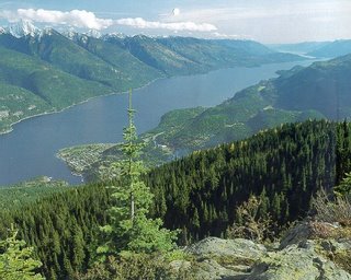 on Kootenay Lake. Virginia drove and I cycled over the 55km pass over the Kokanee Range. The first 25 km's climbs about 600m in steady fashion. To the right I passed Idaho Peak, Selkirk Peak, Mt. Payne and Reco Mountain. This is old mining country and I passed many mine building circa 1800. I climbed above the snow line and was gratified to have brought my vest and arm warmers. On the descent into Kaslo I rode beside the Kaslo River as it tumbled towards the lake. In several places the water was lapping the side of the pavement. I could hear large boulders banging and crashing underwater. This is one of the most beautiful rides I have ever done. 55km’s and I saw 2 cars.
Kaslo is very cool town. Built about 1890 as a terminus for the mining industry and serviced by the lakes paddle wheelers it was one of the most populated areas in western North America rivaling San Francisco in size. As the gold veins ran out the town downsized to its 700 permanent residents. It has a terrific mayday parade (For you American readers Mayday is the day we raise a cup of tea and celebrate good Queen Victoria’s birthday). The parade travels down the main street and if you missed it the first time in turns back and does it again. We rented a cabin by the lake as the weather is a little rainy. I did a little running and paddling but mostly I laid back and read my book. We spent some time looking for property but did not find anything suitable.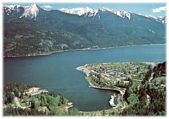
Tuesday May 23 2006
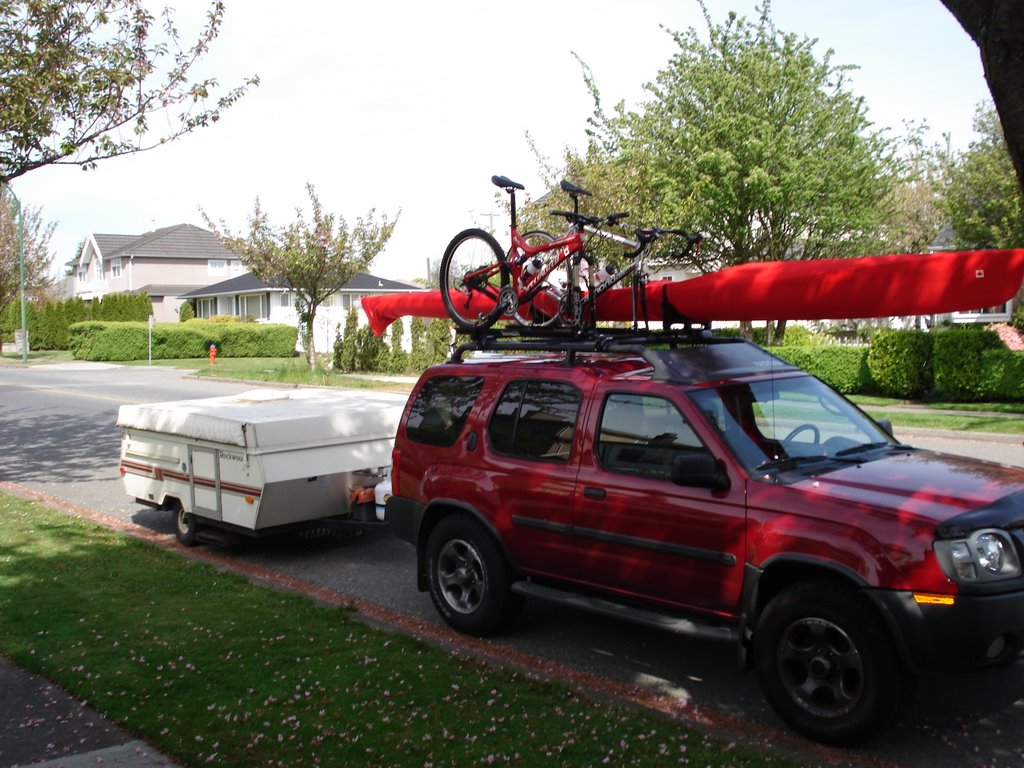
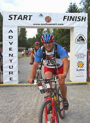
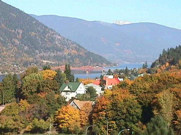
We have decided to move on to Nelson, about 70 km’s south of Kaslo. The lake branches just to the north of Nelson which sits on the west arm. The drive is very twisty and climbs and drops with at least one single lane wooden bridge. When we get settled I think I will ride the Nelson – Castlegar – New Denver – Kaslo – Nelson loop. Nelson is a mountain town. I love it here. The population is about 10,000. Built about 1890. The main street is a wonderful collection of heritage buildings. We have looked at a house built about 100 years ago. Check out WWW.MLS.CA reference #116786. I rode with the Nelson Cycling Club in the afternoon. Another hammer fest east along the lake. The ride leaves Gerrick’s Cycles on the north end of Baker Street at 5:30PM. I joined the Nelson Cycling Club (costs $20.00) for insurance purposes. This club is composed of both mtn and road cyclists. They are registered with Cycling BC and lobby locally for trail access to forests and local cycling issues. There is a great Triathlon here on August 6th. I hope to have a place here by then. On Friday we are off to Salmo to look at a small ranch on the river. More to follow!
Today saw us travel from Grand Forks to New Denver on the east side of Slocan Lake. From Grand Forks we traveled over Paulsen Pass into Castlegar then we turned north up the Slocan Valley to Slocan Lake. Spectacular! River levels were very high and there was a flood warning for local residents. We had considered this area to live in and there were some great hobby farms for sale but the lack of flat water paddling and limited road riding made us carry on to New Denver. New Denver is a terrific little town. It sits on the east shore of Slocan Lake.
 Valhalla Provincial Park to the west with the New Denver Glacier hanging off the front of the mountain peak. We camped just outside of town on Wilson Creek. Paddling was terrific. Imagine kayaking on the lake in the first Lord of the Rings movie. Waterfalls dropping into the dead calm water. Deer browsing on the cliffs above. Hundreds of streams and creeks cascading down into the lake and me, the only one on it. The lake itself is about 2,000’ above sea level and the peaks above are about 8,000’. New Denver is centered between 4 provincial parks which incorporate parts of the Valhalla, Purcell and Monashee mountain ranges. Arguably the best back country skiing in the world.
Saturday May 20 2006
I rode the Wilson Creek trail. Flows really well with some good climbs. A solid cross country ride. As I crossed a cut block about 100 meters down slope I am sure I passed a grizzly bear. It must have been 4.5’ at the shoulder. It glanced over its shoulder at me as it casually browsed on some grass. I have had many bear encounters in the woods but this is only the second time I have encountered a grizzly and I can tell you they scare the shit out of me. I had hoped to mtn bike the Wakefield Trail off of Idaho Peak. This trail starts at 2205m and ends at about 600m. It traverses alpine meadow avalanche slope and rain forest. I will have to return in a couple months when the snow is gone.
Sunday May 21 2006
We have decided to move one mountain range east to the small village of Kaslo
 on Kootenay Lake. Virginia drove and I cycled over the 55km pass over the Kokanee Range. The first 25 km's climbs about 600m in steady fashion. To the right I passed Idaho Peak, Selkirk Peak, Mt. Payne and Reco Mountain. This is old mining country and I passed many mine building circa 1800. I climbed above the snow line and was gratified to have brought my vest and arm warmers. On the descent into Kaslo I rode beside the Kaslo River as it tumbled towards the lake. In several places the water was lapping the side of the pavement. I could hear large boulders banging and crashing underwater. This is one of the most beautiful rides I have ever done. 55km’s and I saw 2 cars.
Kaslo is very cool town. Built about 1890 as a terminus for the mining industry and serviced by the lakes paddle wheelers it was one of the most populated areas in western North America rivaling San Francisco in size. As the gold veins ran out the town downsized to its 700 permanent residents. It has a terrific mayday parade (For you American readers Mayday is the day we raise a cup of tea and celebrate good Queen Victoria’s birthday). The parade travels down the main street and if you missed it the first time in turns back and does it again. We rented a cabin by the lake as the weather is a little rainy. I did a little running and paddling but mostly I laid back and read my book. We spent some time looking for property but did not find anything suitable.

Tuesday May 23 2006
We have decided to move on to Nelson, about 70 km’s south of Kaslo. The lake branches just to the north of Nelson which sits on the west arm. The drive is very twisty and climbs and drops with at least one single lane wooden bridge. When we get settled I think I will ride the Nelson – Castlegar – New Denver – Kaslo – Nelson loop. Nelson is a mountain town. I love it here. The population is about 10,000. Built about 1890.
 The main street is a wonderful collection of heritage buildings. We have looked at a house built about 100 years ago. Check out WWW.MLS.CA reference #116786. I rode with the Nelson Cycling Club in the afternoon. Another hammer fest east along the lake. The ride leaves Gerrick’s Cycles on the north end of Baker Street at 5:30PM. I joined the Nelson Cycling Club (costs $20.00) for insurance purposes. This club is composed of both mtn and road cyclists. They are registered with Cycling BC and lobby locally for trail access to forests and local cycling issues. There is a great Triathlon here on August 6th. I hope to have a place here by then. On Friday we are off to Salmo to look at a small ranch on the river. More to follow!
posted by Bill at 8:41 AM
0 comments
![]()
![]()